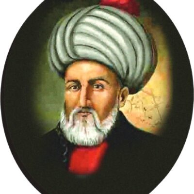
1513, Piri Reis World Map Piri Reis, whose real name is Muhyiddin Piri Bey, was born in Gelibolu in 1465. He comes from a family relocated from Karaman to Istanbul during the reign of Fatih Sultan Mehmet. The family did not stay long in Istanbul and moved to Gelibolu. Piri learned seamanship from his uncle Kemal Reis. Between 1487 and 1493, he gained his first experiences by engaging in piracy with his uncle in the Mediterranean waters. Upon the invitation of II. Beyazıt to all sailors in the Mediterranean to join the Ottoman Navy, he entered the service of the Ottoman navy with his uncle in 1494.
Piri Reis became a war captain for the first time in the war of the Ottoman Navy against the Venetian Navy. Between 1495 and 1510, Piri Reis took on successful roles in naval expeditions such as İnebahtı, Moton, Koron, Navarin, Midilli, and Rodos. During his voyages in the Mediterranean, he noted the places he saw and the events he experienced, later drafting them as the Book of Navigation, which would become the first guidebook in world navigation.
After the death of his uncle in 1511, Piri Reis settled in Gelibolu. Although he participated in some expeditions in the Mediterranean with his cousin Muhiddin Reis under the command of the Brothers, he mainly spent his time working on his maps and book in Gelibolu.
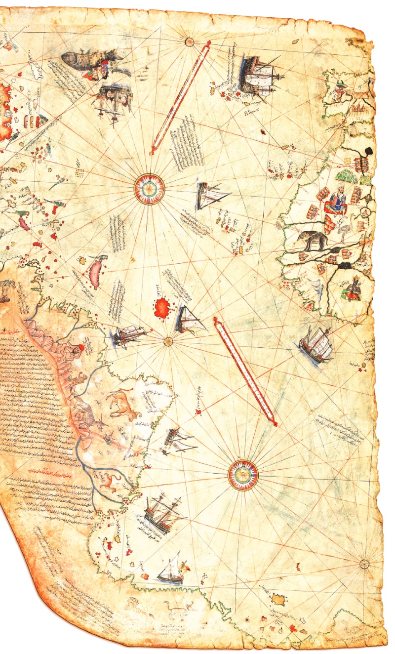
Using these maps and his own observations, he drew the first world map in 1513. The one-third piece covering the Atlantic Ocean, the Iberian Peninsula, the west of Africa, and the eastern coasts of the New World America is the part of this map that exists today. What makes this map significant on a global scale is the rumor that it contains information from Christopher Columbus's map of America, which has not survived to the present day.
Piri Reis earned the sultan's praise for his successes in the capture of Alexandria and presented his map to the sultan during the campaign. Today, a part of this map exists, while the other part is missing. According to some historians, the Ottoman sultan looked at the world map and said, "How small the world is..." Then, he divided the map in two and said, "We will keep the eastern part in our hands..." The sultan later discarded the other half, which would be found in 1929. Some sources even claim that the sultan intended to use the missing eastern half for a possible campaign to seize control of the Indian Ocean and its Spice Route. After the campaign, Piri Reis returned to Gelibolu to create a book for Bahriye from his notes. He compiled his maritime notes into a Nautical Book (Navigation Guide) called Kitab-ı Bahriye. Dardanelles Strait and Islands (1513, Piri Reis)
Piri Reis also participated in the 1523 Rodos expedition. In 1524, he gained the appreciation and support of the grand vizier Pargalı Damat İbrahim Pasha, whom he guided during the Egypt voyage, and in 1525, he presented his revised Kitab-ı Bahriye to Kanuni through İbrahim Pasha. In 1528, Piri Reis drew a second world map, more comprehensive than the first. In 1533, when Barbaros Hayrettin Pasha became the grand admiral, Piri Reis received the title of Derya Sancak Bey (Rear Admiral). After Barbaros's death in 1546, he served as the Captain of Egypt (also known as the Captain of the Indian Seas). He was quite old during his naval duties in the Oman Sea, the Red Sea, and the Persian Gulf. During his last duty in the Ottoman navy, he was executed in 1554:
"Sultaniye (The Castles Known as Çanakkale and Kilitbahir):
The late Fatih Sultan Mehmed Gazi, may Allah judge him with vast mercy. The reason they call the castle on the Anatolian side of these mentioned castles Sultaniye (Çanakkale) is this: Fatih Sultan Mehmed, the father of Prince Sultan Mustafa, came to this castle and had a castle built. The reason they call the castle on the Rumeli side Kilitbahir is this: Ships coming out of the Marmara take the passage permit from the castle on the Rumeli side, so they called the castle on the Rumeli side Bahr-i Kilit (Kilitbahir). However, it is not possible for large ships to anchor in front of the castle on the Rumeli side. Because it is a current place and deep. Only small ships can anchor. They must come very close to the shore and lie down. However, since there are beautiful and wide harbors around the castle on the Anatolian side, the situation was presented to the sultan, and an order was issued to take permits from here.
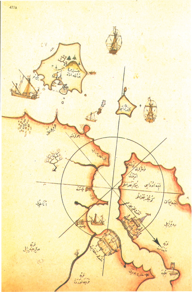
Bozcaada (Tenedos)
First, those who leave the caliphate center, Istanbul, for the Mediterranean should know that there is no island closer to the Sultaniye and Kilitbahir castles in the Dardanelles than this island.
The following story is told about this island: Opposite Bozcaada, on the Anatolian coast, there was a castle known as Old Istanbul and famous among infidels as Troy, which was once prosperous but now in ruins, while there was no castle on Bozcaada. It has a harbor suitable for ships to dock. Since Old Istanbul was extremely prosperous, merchants coming and going there made great profits. Therefore, European merchants always came and went here by ships.
Often, pirate ships also came and hid in the harbor of the mentioned Bozcaada. When ships coming for trade arrived, they would attack them, take their goods and belongings, and lead many astray. Because of this, Venetian and Genoese merchants came together and had a castle built on the mentioned island. With the construction of this castle, the merchants of that time were safe. Later, as Muslims became victorious in these regions and found opportunities and victories, Old Istanbul began to fall into ruin. The infidels in the cities and castles on the Anatolian coasts, which were conquered, could no longer stay here. When they intended to leave their cities and go to Europe, they also destroyed the castle they had built on Bozcaada and left it in ruins. Dardanelles Strait and Gallipoli Peninsula (1513, Piri Reis)
From those times until now, the castle of Bozcaada remained in ruins. When the late Fatih Sultan Mehmed Han ascended the throne and began to deal with state affairs, he deemed it reasonable and appropriate to build a castle on Bozcaada so that those engaged in maritime trade could be safe and secure during their voyages. Therefore, he ordered the construction of a castle on the mentioned island. Thus, he prevented foreign ships from entering that harbor. Because the mentioned harbor is seven miles away from the Anatolian coast. Again, from this island, Yenişehir Cape at the mouth of the Dardanelles is twelve miles away. From Yenişehir Cape to Çanakkale (Sultaniye Castle) is eighteen miles. With this calculation, the distance between Çanakkale and the mentioned island is thirty miles. However, the circumference of the mentioned island is also eighteen miles. The island has low elevation and flat areas. Its high place is a gray pointed hill on the Yıldız side. When you climb this island, you can see ships moving at sea from a distance of forty miles. Those passing by ships can see that hill from a distance of thirty to forty miles as a tent. The sign of Bozcaada from the sea is this mentioned hill. On the northwest side of the hill, there is a small and low island. Boats cannot pass between this small island and Bozcaada. It is shallow. However, large ships can pass between the other small islands. Opposite the castle, there is another small island at a distance of one mile. On the south side of that small island, there is a stone in the sea. Ships can pass on all sides of that stone; it is deep. After that, on the south side of the mentioned castle, there is another small island. This small island is very close to Bozcaada.
However, large ships pass between the two. Again, on its south side, there is a bay. This bay is called Yardım Harbor. It is a shelter for small ships on windy days. Large pieces lie at sea.
Everywhere is suitable for anchoring. The surroundings of Bozcaada are shallow waters. Anchors hold.
In addition, the Anatolian coasts opposite Bozcaada are also shallow waters. Two or three miles at sea, on windy days and in summer, large barges anchor and lie down. But the best harbor on the mentioned Anatolian coast is Kum Cape. The south side of this cape is a good bed on windy days. However, there is no bed on those coasts against winds coming from the sea. After that, on the north side of Kum Cape, there is a harbor they call Çökertme, which is a shallow harbor. It is necessary to anchor two miles offshore from these shallows. If you want to reach this Çökertme harbor, you need to approach the coasts from the south; these areas are deep. It is a good bed for galleys and heavy barges. The mentioned shallows cut off the sea side. From this mentioned harbor, Hımar Island is ten miles away in the west direction. This Hımar island is in four pieces. One piece is attached to Hımar island. Boats cannot pass between them. They are rocky places. The other two small islands are located on the southeast side of the mentioned island. Boats can pass between those two small islands. But these mentioned two small islands remain on the southeast side of Hımar island, and Hımar island falls on the northwest side. Large ships can pass between the two. The main ship bed is in the middle of these four-piece islands. They can come against all winds and continue their way. If they need drinking water, there is a well in the middle of that large island.
On the north side of the mentioned island, there is also a stone. This stone is invisible. Caution is needed. Again, the distance between the mentioned island and Imroz island is twenty-five miles and is in the north direction.
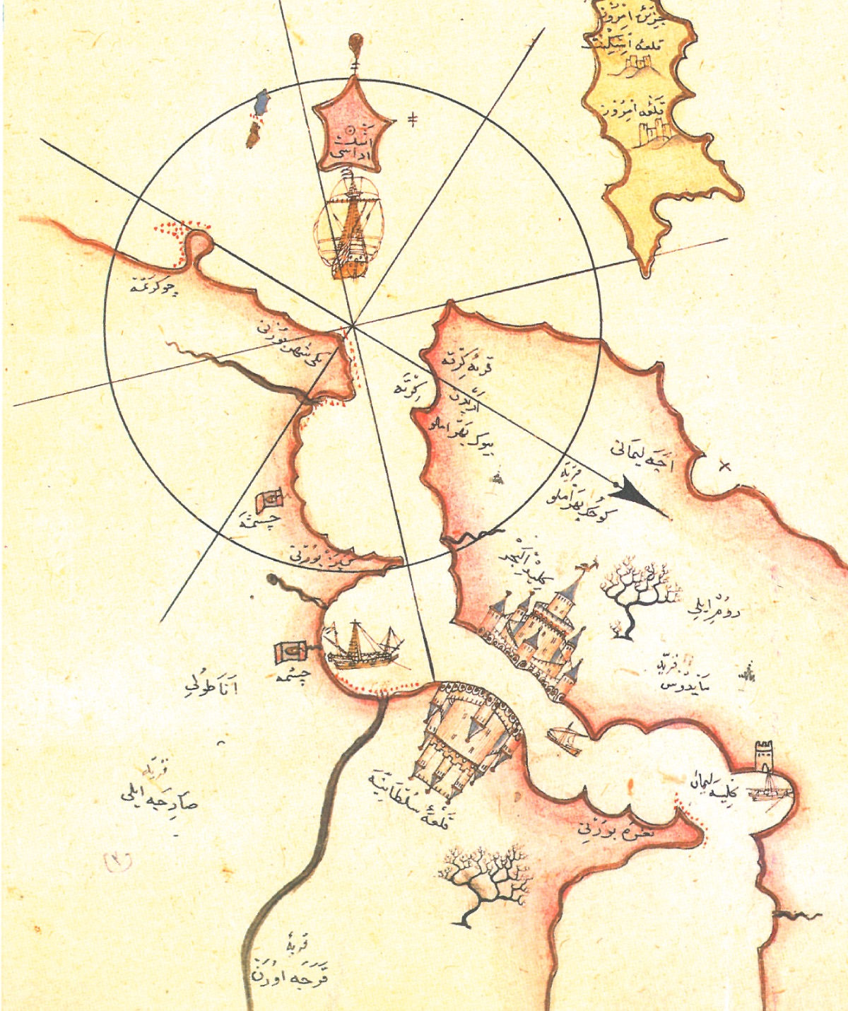
Gökçeada (Imroz):
Those who narrate past events tell the following about this Imroz island: On the opposite side of the island, on the Rumeli side, on the Eceabad coasts, as it is now, there were watchers in the past when coming to the strait. The prosperity of this island is due to the need to give warning signals to the sailors on the Eceabad coasts. Thus, on Imroz island, however many ships were seen on the sea, they would signal with smoke during the day and with fire at night. The watchers in Eceabad would also inform Istanbul of the situation within an hour, according to the signal they received from Imroz island. The Dardanelles and Fortresses (1513, Piri Reis)
After Emperor Constantine, a very long time passed. At one point, the Venetians found an opportunity and seized the mentioned island, taking it under their control. When it came to the time of Fatih Sultan Mehmed Han, immediately after the conquest of the island of Eğriboz, this island also came under Ottoman control.
Entrance to the Dardanelles and Beşik Bay (1513, Piri Reis) Now this island has two castles and they are well-maintained. One of these castles is called İskinit. It is built on a large rock in the middle of the mentioned island, away from the sea. The second castle is called Imroz. This castle is on the northwest side of the island, on the sea, built on a large rock. In front of this castle, there is a small bay in front of the vineyards. They pull the ships coming to this castle to the shore at the bottom of this bay. It is an open place. Large ships cannot lie down.
The circumference of this island is fifty miles. There is a long mountain on the island. The west side of that mountain is low, and the east side is high. On the east side of the island, there is a cape called Kifelos Cape. From this cape, the Eceabad coasts in Rumeli are eighteen miles. The tip of this cape is shallow, caution is needed. On the southwest side, there is a bay called Kömür Harbor. This bay is a bed on windy days. However, caution is needed on windy days. Five miles away from this Kömür Harbor Cape, on the Aynaroz side, there is a shallow in the sea. Ships pass over that shallow. However, on calm days, the bottom of the sea is visible. Thus, it is known."