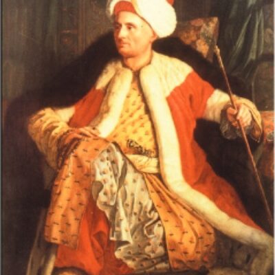
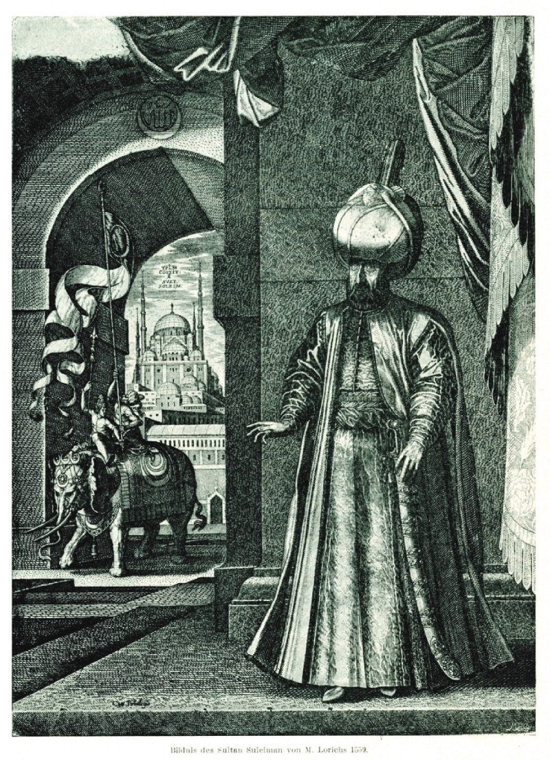
Kanuni Sultan Süleyman (1559, M Lorichs) Philippe du Fresne F (1551-1610) was born into a wealthy family in Paris and studied law in Heidelberg. The Canaye family became prominent as merchants and industrialists in the early 16th century. Philippe du Fresne embarked on travels to Germany and Italy at the age of fifteen. Seven years later, in 1572, Fresne joined a diplomatic mission to Venice. Here, he defied his father's order to go to Valencia for legal studies and stayed for a while. During this time, he met Massiot, the secretary of France's ambassador to Istanbul, Noailles, in Venice. The secretary was waiting for favorable winds to cross the Adriatic Sea. This was a golden opportunity for the twenty-year-old Fresne. Therefore, Fresne went to Dubrovnik and joined Noailles' entourage. Noailles set out on January 14, 1573, to reach Istanbul. Fresne was with Noailles throughout the journey. They reached Pera on February 28, 1573. Fresne stayed in Istanbul until June 9, when he left the ambassador and traveled to Venice via the Aegean islands, the coast of Morea, and the Ionian islands, returning to France a year later. During his stay in Istanbul, Fresne Canaye read works by authors who had traveled the Aegean region (P. Belon, A. Thevet, P. Gilles, B. Ramberti, J. Gassot, G. Postel, N. de Nicolay). Therefore, the influences of other authors can be seen in his impressions. It is especially possible to see the enchantment of Homer's epics and a Philhellenist perspective. However, unlike previous travelers who identified Troy with the ruins of Alexandria Troas opposite Bozcaada, Fresne was among the first travelers to say that this theory was incorrect because the ruins here belonged to the Roman period. In this respect, it is a turning point in the research to find out where Troy was. Despite this, Fresne describes the ruins of Alexandria Troas as Ilion "out of respect for ancient researchers":
"...July 9. Thanks to favorable winds, we reached Gelibolu, a large and ancient city on the European coast, early in the day. Gelibolu is situated on a slightly elevated promontory. It lies at the foot of the uniquely refreshing and pleasant hills of the Hellespont, right where the sea begins to narrow. The entire population of the city consists of Turks. Here, one can see ancient walls, some parts rising from the sea, others located on the shore. There are many mosques in the city and an old castle where the Gelibolu banner is hoisted. The harbor is not very safe.
Outside Gelibolu, about a mile away, there is a mosque and nearby a tomb. The tomb is surrounded on all sides by olive trees and other very beautiful trees; it has a very pleasant location due to the cool green shades (the author describes Bolayır and the tomb of Süleyman Pasha without naming them. R.A). According to one rumor, Orhan lies in this tomb, while another suggests that it is Sultan Murad, the first to cross into Europe and occupy Gelibolu.
On the Anatolian side, directly opposite Gelibolu, at the exact location of ancient Lampsakos, there is a Turkish village called Çardak.
The current in the Dardanelles is as fast as the Rhome River: So much so that when other rivers with the fastest flow encounter this strait, they seem very slow and sluggish. We regret not being able to explore such a beautiful region more comfortably. However, the Rumeli coast is superior in beauty to the Anatolian coast. Among these not very high small mountains, there are plains adorned with olive trees and very beautiful fragrant and clear-water streams. Compared to the very, very beautiful and very charming valleys here, the Spoleto valley is much more beautiful, and even the Mognone plain would be envious. Towards the middle of the Dardanelles, on the Rumeli coast, we saw the ruins of a very old fortress on the top of a higher and more barren mountain than the others; this place is known as Khoriakeros by the Greeks and Domuz (meaning the same) by the Turks. This is the first fortress the Turks took from the Byzantine Empire in Europe. The Byzantine emperor, who learned that this rock had fallen into Turkish hands and was unaware of the judgment God had reached for both himself and his people, was not affected by this news and said with a smile (referring to the name of the fortress) that it was of no importance for an emperor to lose a pig.
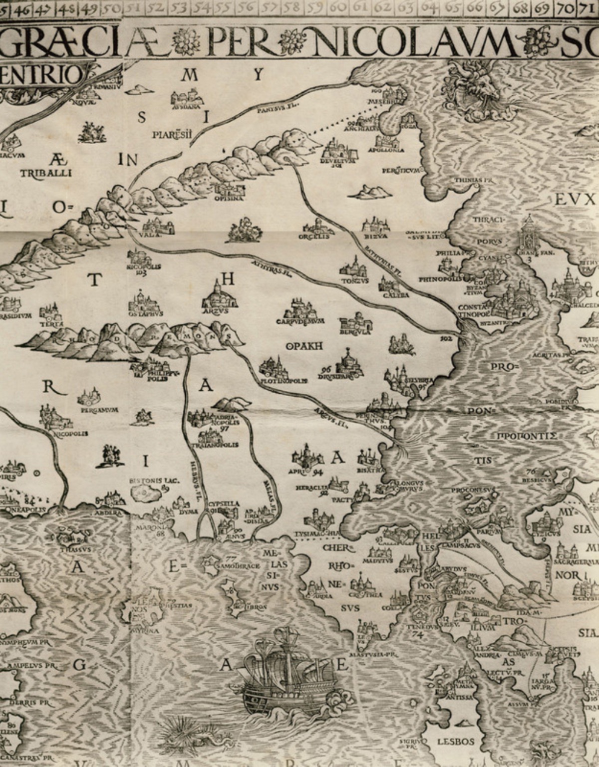
We arrived at Maydos (ancient Madytos/Eceabat R.A.) not by sailing but as if flying. This is a Turkish village on the Rumeli coast today, famous for its exceptional wines. While sailing towards the fortresses, due to both the strength of the current and the wind, our ship took on water for a long time; those in the fortresses signaled with fires, warning that they would open fire; however, just at that moment, we anchored. After arming the ship, the shipowner went to the governor; despite having the Sultan's decrees, he had to pay two kuruş to the artilleryman; the artilleryman, without considering the contrary wind, wanted the ship to withdraw immediately and said that the Sultan had ordered him to keep all ships outside the range of the cannons. The shipowner returned to the ship with a Spanish convert sipahi; he flattered the sipahi quite a bit to avoid being played a bad trick. We learned from this sipahi that the Ottoman navy set out on July 5. Troas Region and Islands (1573, Philippe Canaye)
The fortresses are not located where the ancient Sestos and Abydos were, but a little further down; because the fortress on the Anatolian side is located where Dardanos (or Dardania) used to be, and it is still called Dardanelles today. The fortress on the Rumeli side (Kilitbahir Castle, Kale-i Sultaniye) is on the top of a mountain covered with beautiful vineyards; it is clear that the entire fortress was built at the same time. Because the high and square-shaped tower built in the middle of a heart-shaped spur is much older than the walls surrounding this spur and extending along the coast; in these walls: there are about twenty-five cannons protecting the passage on this side.
However, the fortress on the Anatolian side (Çanakkale Castle, Kal-i Osmaniye) is much more fortified; because it is built at the end of a vast and endless rural area, and it is impossible to attack this fortress from the nearby mountains. It is surrounded by deep moats with sea water flowing through them. In the middle, there is a terrace and many cannons; however, no one enters here because they know very well that the keys to Istanbul are here and the security of the Turkish Empire depends on these two fortresses. On the walls of the fortress in Asia (just like the other one, extending down to the shore), there are twenty-five or thirty gates, each with cannons that can fire at water level; so much so that no matter how small, a palaskerme (light sailing skiff) cannot pass without being hit by cannon fire from either side.
We stayed at the fortresses for days while waiting for goods to fill the ship. Because the town was dirty and the coast was very bare (there was neither shade nor a fountain), we spent the whole day on the ship. In the evening, when it cooled down, we went for walks and swimming, then cast our nets and pulled them in the next morning full of delicious fish. This amusement lasted until one night, just when we thought we were doing a very profitable business, the current took us and carried us away.
Shortly after our arrival at the fortresses, the Spanish convert who visited us became so accustomed to us that he began to dine with us every evening, and after dinner or at dawn the next morning, he would take us and show us the surroundings full of all kinds of fruits, especially vineyards: In these vineyards, we often tasted very beautiful grape juices.
In these plains, the small Simoeis (Dümrek stream) river flows, which dries up in this season; however, this river is no longer called by this name; we recognized this stream, which all Greek maps give as Simoeis, as soon as we saw it in this large plain.
During our stay in the Dardanelles, a ship passed every half hour or less. Although these ships were sent by the Sultan, they still lowered their sails and did not pass without obtaining a permit from the fortress official. However, those heading towards Istanbul (whether Turkish or Christian) pass without any difficulty and are not searched; here there is "facilis descensus Averni" (ease of entry to Hell); however, as we have experienced, getting out of here is very difficult. Just as we were about to set sail, a sinister Greek from Gelibolu, accompanied by a janissary and other Turks, appeared before the judge of the Kaleler town and declared that we were slaves who had bought our freedom. The Greek read us a decree granting him the right to collect this tax, as he held a privilege document obtained from the Sultan, according to which slaves who had bought their freedom were obliged to pay him a tax if they came to the Dardanelles. We appeared before the judge with the Sultan's permit in hand, with pleasure; we presented our document to the judge, who was sitting with the town's notables.
The judge took the document, kissed it respectfully, then brought it to his turban as a sign of great respect. He had a muezzin sitting next to him read the document aloud. After hearing in detail what privileges the Sultan granted us with this document (because the Sultan granted us the right to wear a turban whenever we wanted without being searched by any officer or official), he paid us great compliments and spoke very nicely. The rascal Greek from Mavra (?) returned to Gelibolu in a fit of rage with his false witnesses; we, having escaped this slander, walked back to the ship in joy and delight, but we could not avoid paying 42 akçe to the scribe who wanted a copy of the decree.
July 18. They came to search us on the grounds that we had insulted the customs officers, and this search cost the ship 36 ducats. They not only searched our weights but also counted everyone one by one: For if even one more person than was written in the permit had been found (as required by the regulations), they would have enslaved us all. However, if you give a few small gifts and tips and say a few nice words to those performing this duty, they do not show the diligence they should during the search; otherwise, they are very strict and spend half a day searching every corner of the ship and create big problems over the slightest thing. But thanks to our Spanish convert (we had previously given him the recommendation letters the Sultan had given to the esteemed ambassador, the Pasha, and three écus), our affairs were handled quickly. After paying a ducat each to the fortress official and the artilleryman as anchorage fees, we set sail again, filled with joy like people who had just escaped from a very terrible prison and regained their freedom. We left the fortresses with a very favorable wind; when we were between the two fortresses, we estimated that the strait was three miles wide at this point. But towards Eceabat, where Sestos and Abydos used to be, the strait is a bit wider. Except for some strategies recently employed by the Spaniards, it is impossible to cross this strait without experiencing great dangers (because there are many cannons firing at sea level here). When the Spaniards arrived at the fortresses on their return from Istanbul, they stopped as usual and thus made the fortress official think they were some galleys returning to the navy. All of them, who were captives and had agreed with their captain to save themselves by throwing themselves into Christian lands, quietly weighed anchor at midnight when a favorable wind arose, taking every risk to gain freedom, and escaped without anyone noticing. When the incident was reported to Mehmed Pasha, the fortress official was summoned, and what happened to him has been unknown since that day.
The Dardanelles widens after passing the fortresses and ends at the Margariti (?) bay at the Sula or Spedo (?) cape on the European side; here the Aegean Sea is so wide that the Rumeli coasts are not visible. This cape is 15 miles from the fortresses: Thus, the total length of the Dardanelles, starting from Gelibolu, is 45 miles.
Later, we passed the Janissary cape (located near the Sigeon cape, where the ancient city of the same name was located, and today Yenişehir is located there R.A.); on the Asian coast, some walls are said to be the remains of the palace of King Priam of Troy. The location of this cape clearly shows that it is "Siegeum promontorieum"; Constantinus initially planned to establish Istanbul here and began the construction of the city. It is more plausible that these walls are not from ancient Troy but from the city that Constantinus began to build.
The lands where the fortresses are visible are mountainous and less fertile up to Troy. In the lands of Troy, there are plenty of oak trees, and the acorns obtained are taken to Venice for use in leather dyeing, yielding great profits.
Beyond the Janissary or Siegeon cape, we encountered three deserted islands called Karayer by the Turks and Mauria by the Greeks (Snake, Leek, and Rabbit islands, R.A..), and a little further away, towards Rumeli, the islands of Gökçeada (Imbros) and Semadirek (Samothraki) with high mountains. In one breath, we reached Bozcaada (Tenedos); this is a very famous island 30 miles from the fortresses: It is famous both for its exceptional wines and for being the base of the ships that destroyed Troy. We anchored under a rock near the island. Because we did not want to enter the town harbor where there was an epidemic. Later, we saw the town from a distance, built at the foot of a small mountain cut like a diamond peak, which has been visible since the fortresses.
At the upper side of the town, at the highest point, there is a fortress built in the Christian style, and Turkish guards reside there. The circumference of this island is about 30 miles, and it has only one town. Since we could not go there due to the epidemic, we went to the Greeks who had left their homes infected with the epidemic and were living in huts in the countryside; we bought grapes and various fruits from them and sought its very strong wine; the grapes from which these wines are made grow on very hot and bare sands. One day, while we were at Solazzo (?) near a fountain, we saw the remains of an old church said to have been built by Constantinus, according to the locals.
Bozcaada is 10 miles from Anatolia, directly opposite Troy, where some remains can still be found. As I mentioned earlier, it is necessary to believe that the remains seen today do not belong to ancient Troy, but are the remains of cities established later by many Roman empires. However, seeing that all maps place ancient Ilion (the previous name of Troy. R.A..) here, out of respect for the ancients, I will describe Ilion to you as much as I could see during my five-day stay here.
Ilion is very close to the foothills of Mount Ida (Kaz Dağı) from the north, which is not very high and is covered with tall and old oak trees, and is located in a plain that is undulating with hills here and there. It is interesting that there is no harbor, nor any trace of a harbor, even though it is 6 miles from the coast. The whole country is covered with forests "except for some small vineyards"; wheat does not grow here, so only oat bread is eaten in the Turkish villages here. The Küçük Menderes river, which originates from Mount Ida, is no longer visible. There are hot springs, but vagrants have desolated this place, filled with bushes, brambles, and thorns; even today, it seems as if the sadness and sorrow caused by the ruin of such a great city are felt. Since I did not see anything worth remembering, this much information is sufficient for ancient enthusiasts.
July 24. After loading before dawn, stacking the loads and ballast, we weighed anchor with a very pleasant star wind and reached the cape called Lekto by the Greeks and Baba Burnu by the Turks in the early morning; Baba Burnu is 40 miles from Bozcaada and there is a channel between it and the island of Lesbos."