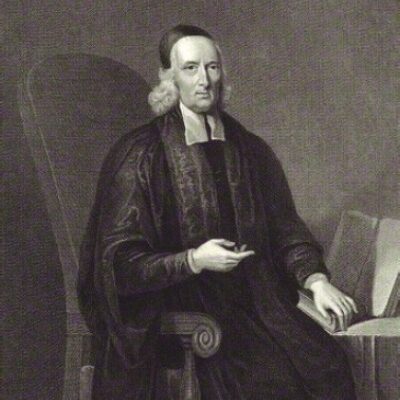
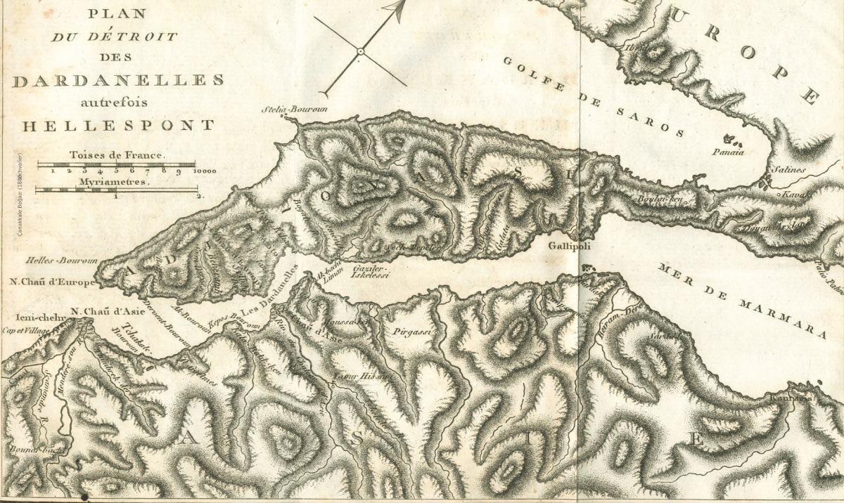
Dardanelles Strait (1800, Lechvalier) George Wheler (1650-1723) was born in the Netherlands as a member of a noble English family. Educated at Oxford, Wheler embarked on a European tour in 1673. During this journey, he met the French physicist Jacob Spon in Venice, and they decided to undertake a long journey to the East together. After their Aegean and Anatolian tour between 1675-1676 with J. Spon, he published his travelogue in 1682, which was largely a copy of Spon's work published in 1678. The route of the journey was Venice, Greece, Delos, and Istanbul. During this trip, Wheler referred to ancient writers as well as the works of travelers who had visited the same region before him. Throughout his journey, Wheler donated archaeological artifacts such as statues, inscriptions, and coins, as well as nearly a thousand plants, to Oxford University. After this journey, he pursued a career in theology and began working as a priest in churches. In 1689, he also wrote a book about Christian churches. Although his writings about the Çanakkale region largely repeat Spon's writings, they are significant for continuing the critical approach to Sandys' localization of Troy by previous travelers and for providing detailed information about Alexandria Troas and some villages:
"However, we returned to our ship at Bozcaada (Tenedos). This island is four or five miles from the Asian coast, with a diameter of about twenty miles; the island has very fertile corn and wine; especially muscat wine; most of these go to Istanbul. There is a town and a castle to the north; but towards the cape is Sigeum, to the east is the place now called Janizzari (Yenişehir) by the Turks; this place fell into the hands of the Venetians with the War of Candia. It was taken back by the Turks and later given to the faithless governor for a good amount of money. The famous battle between the Venetians and the Turks took place near here, with heavy losses on both sides; the victory was the Venetians'.
From our ship at the southern end of Bozcaada (Tenedos), we discovered the famous Mount Ida, and in the same line, on the Asian coast, the city we believed to be the much-praised Troy, which we wanted to visit as we would be very disappointed if we did not see it. On August 20, the wind was still either blowing against us or very calm, and our ship needed wood and water, so a longboat was sent ashore with some people, and we took the opportunity to join them to see the famous land of Troy. We landed on a plain three miles north of the ruins; the sailors found fresh water in a channel dug into the sand (I believe it is a secret channel dug again for some purpose) that we saw from the ship. Some parts of the plain were cultivated, and crops were growing in some places. Corn, cotton, and sesame (from which they make oil) were growing, along with a variety of cucumbers and a type of watermelon called Angurai by the Italians, and another type called zucchi (Watermelon R.A) here. I also saw fig and various apricot trees with fruits on them in many places. Here I also saw a very dense type of oak tree that I had never seen in England...
When we approached the ruins of the city, we saw many broken marble columns, walls, and foundations along the shore; none of them were standing upright, they were all lying on the ground, many of them towards the sea; they were weathered and damaged by the salty wind. A little further on, along the shore, there was a bay that undoubtedly once had a beautiful marble columned port, with some columns still standing on the shore, and a long and thick wall that resembled a port. The mouth of this place was filled with sand and had become very shallow. It was difficult for me to say that this was the port of the famous Troy in ancient times, the city where the wars praised by Homer and Vergilius took place, Ilium or Troy. None of the remains here are older than the Roman period; despite Bellonius having believed this and Petro della Valle being unable to refrain from shouting that every great tree was a Hector, Achilles, or Aeneas and all the bushes were their armies.
"Hic Dolopum manus, hic saevus tendebat Achilles; classibus hic locus, hic acie certare solebant." (Quote from the second book of Vergilius' Aeneid, R.A.).
This place is more like the city that Strabo described as modern Ilium for his time, the place where the village of the Trojans was, which Alexander the Great began to build, completed by Lysimachus, named Alexandria, later made a Roman colony, and enriched with many advantages. As the valuable Mr. Sandys from our nation also pointed out and described in detail, we should trust Strabo and his guidance. But to continue: Above this port, there are many marble tombs; some have Apollo heads, and some have small round shield reliefs, but we did not see any with inscriptions. Monsieur Spon identified that their forms resembled Roman tombs in Arles, France. Therefore, contrary to what Petro della Valle imagined, we decided that none of them belonged to ancient Troy. A little further south of the port, there were two columns lying on the ground, each thirty feet long (1 foot = 30.48 cm; R.A.), and one of them was broken. Monsieur Spon measured the columns made of Egyptian granite marble, the last of which had a diameter of four feet and nine inches. The Grand Signior (Grand Signior/Ruler, R.A) had many columns transported here for the Yeni Mosque built for the Sultan's mother. As we moved a little further along the shore, we passed ruins that we think were an aqueduct carrying water to the port. As we moved away, we reached a long and deep man-made channel or valley, perhaps made for boats to enter the city from the sea. But now they are all dried up, and along this valley or behind it, a little to the right, we come to a quite significant ruin, where it is very clear that there are large remains. There is a theater, a ruined temple with arches on top, and walls and foundations belonging to a palace... Gallipoli and Istanbul (1544, Jerome Maurand)
It is quite easy to climb to the top of the hill from the seaside, as it is not very high, but it is full of remains of a rather magnificent structure. It is very difficult to identify whether it is a castle, a temple, or a Christian church. Since no one has done it so far, I will describe its dimensions.
Its entire length from north to south is four hundred and thirteen feet (1 foot = 30.48 cm; R.A.) and its width from east to west is two hundred and twenty feet. Its front faces west: at the entrance, there are foundations belonging to two wings, one on the right and the other on the left, parallel to each other. On the left side, it is divided into two quadrangles. The outermost of these is twenty-four feet wide or seventy feet to the north, and only the foundations of the outer wall remain, the ground inside is flat. The next one is thirteen steps wide or thirty feet and has a large vaulted and arched section below the surface. The other wing on the left is equal and thirty steps or ninety feet wide. There is nothing left of it except the foundation wall, and its surface is flat...
It is very easy to go anywhere from this hill. The sea is two miles to the west. To the east is a large plain, with this hill squeezed between them and Mount Ida (Kaz Dağı); most likely the Simois River, which was near ancient Ilium, was not seen by anyone in our group. We will not go further in this direction, but Mr. Sandys was largely proven. To the north is a small plain, then another hill rises, this is the ancient Sigaeum cape, now the Janizzari (Yenişehir) Cape, the entrance point to the Dardanelles (Hellespont), or the distance from this hill to the hill I mentioned above is eight miles. The day ended faster than our curiosity, and we returned to our boat. On the way, we stopped a hundred steps from the shore to drink water; it was just below the arched place north of the ancient port I mentioned to you earlier. The water is so good that they carried it from the secret channel to the boat, two miles to the north.
On the twenty-third of the month, after struggling against the wind for a few days, we reached a point where the castle of Bozcaada (Tenedos) could be seen and anchored. We anchored near the place called Janizzari cape by the Greeks of today's Troas. There is a village called Sigaeum on this cape. This cape controls the entrance to the Dardanelles (Hellespont). There are two very beautiful fountains on the shore here, our ship took its water from here, and from the village, very cheap, especially beans and other foods were bought for the sailors. Fifteen fat chickens for a dollar, which is cheaper than a silver coin; a dozen eggs for a penny and a variety of magnificent watermelons, you can take as many as you want. The inhabitants, Greeks, live off the products they obtain from the land: Among the products are corn, wine, saffron, figs, melons, watermelons, apricots, and other fruits. There are two or three hundred families in the village. The French currency of five pennies (penny) is called a Timin in Turkey and is accepted everywhere and is worth fourteen Asper (a silver coin worth a piaster). Asper is small and does not pass in Constantinople.
On Saturday, August 27, we set sail and anchored south of Gökçeada (Imbros) the same evening to wait for the wind. This island is a little larger than Bozcaada (Tenedos) and is located to the north. It has four villages and is actually protected by a castle. There are quite high mountains, covered with forests, with a large part of them having a type of wild pear tree. There are flocks of rabbits and quite a few wild boars. The Dutch gentlemen hunt them with their dogs and guns, four wild boars in two hours. However, this pleasure cost him dearly; the chief captain set sail earlier than expected. The captain kindly left a boat and four sailors to wait for him; they found us when they anchored inside the castles. After two days and very dangerous weather, the current was still flowing quite strongly at the entrance of the Dardanelles (Hellespont). Monsieur Spon and I were quite scared. We were looking down on the island from the tops of the mountains, and we immediately saw our ship setting sail and descended as quickly as possible to not miss the chance to return with them. Despite everything, I saw that this island has very beautiful valleys and cornfields. There are many beautiful springs, most of them flowing between the rocks, many small pools to swim in; fig trees to sit in their shade, wild vines, vitex, and oleander trees.
On the twenty-eighth, Sunday, we reached the entrance of the Dardanelles (Hellespont) with a side wind and entered in the morning; we saluted the new castles on both sides of the entrance, which draw their power only from the wind and water, with great cannons. We fired seven shots, and as is still customary with the Turks, they responded with one shot. Then we fired five shots as a thank you; the old saluting traditions still continue in these seas. I don't believe these new castles were built in Mr. Sandys' time, as he doesn't mention them at all. From Troas, the Asian coast is not more than two miles from here, the Sigaeum or Jazizzari cape has a flat surface. The opposite cape on the Thracian Peninsula has old-fashioned round castles and many elevations. The entrance is to the west, with a slight incline to the north, continuing for seven or eight miles. Before reaching Çanakkale (Dardanelles) or the old castles (the opposite of the new castles is used), it turns north two or three miles to the Sea of Marmara (Propontis).
When we entered, we passed quite close to an elevation on the north shore, stopped on the other side two or three miles on the south side of the strait, and anchored, but had to anchor deeper to hold better, otherwise, the wind and current could have carried us away. There is always a strong current flowing out towards the Archipelago. This strait is quite famous in history and has changed its name quite often. Besides being called the Sea of Helle or Hellespont because of the drowning of Helle, who fell while flying on the back of a bull to escape the wickedness of her stepmother Ino, the daughter of King Athamas of Thebes, it is also named the strait of Sestos and Abydos, known for the famous love of Hero and Leander. In later periods, it was called the Dardanelles, which I think also suits these old castles; just as the Italians call it Labocca di Constantinopoli, we call it the channel or strait of Constantinople.
The north wind, which sometimes blows for two months without stopping in the summer, is still blowing. It is impossible for us to overcome it; we began to fall waiting for better weather for days. We wanted to go to the village on the Asian coast and rent horses from there, some also suggested going to the old castles and finding a boat there to go to the Bosphorus of Istanbul (Constantinople). While I was preparing on the deck, Monsieur Spon went with them. When they did not return the next day, I went ashore alone to find out what was happening. They took me to a Greek's house where he and the priest from Micone and Seriphus, who came ashore with us for the same purpose, were staying. I found them having breakfast. They were eating grapes, figs, honey, eggs, cheese, and watermelon. All this was laid out for the priest, who was a Caloyer who never ate meat.
The name of this village is Kaınourio Chorio or Yenişehir, there are about two hundred houses, all Greek. I was sitting pleasantly among vineyards and apricot trees...
However, we could not find either a horse or a boat here. Monsieur Spon requested a cart for the two of us, or rather a horse cart. The cart was a two-wheeled cart used to carry fruit from the fields, with two pairs of oxen instead of horses, walking slowly. But even though it took hours, they brought us to the Old Castle, which I think is seven or eight miles away. The consul of the English, Dutch, and Genoese, named Ezechiel Ruser, briefly met with us and quite politely offered us to stay at his or his friend's house; we gladly accepted. He offered us the house of his friend, the Venetian consul Abraham Corfers; both are Jewish, but very kind people.
This castle is now called the Old Castle of Anatolia (Natolia), and the other is called the Castle of Rumelia (Romelia); as if they are naming the Greek and Asia (Asia) continents in this way. However, it used to be called the Dardanelles (Dardanelli). There are two or three thousand people on the Anatolian side. We expected them to protect it better to defend Istanbul (Constantinople). But there is nothing effective; only two or three Gothic-style bastions. This Anatolian castle sits on a low plain, while the other is in a more hilly place; they have opposing cannons; it is not defended from the land in any way. My companions and I decided that these were not the ancient Sestos and Abydos where the famous love of Hero and Leander took place. Because this is neither the narrowest part of the strait, nor is there any ancient ruin here. However, the place we passed, three or four miles north, is narrower and there we found significant ruins on the Anatolian coast. This led us to think that Çanakkale (Dardanelli) was built after these places became ruins. But after analyzing Strabo, I think the city of Dardanos is related to the name Dardanelli and that this name was adapted to the two castles. According to Strabo, Abydos comes after Dardanos, although the distance is different from our more precise measurement, I consider Strabo's seventy stadia or about eight miles distance possible.
We rented a boat slightly larger than a small barge for ten silver coins to take us to Istanbul (Constantinople) and left the castle. As the previous day, the priest from Micone and an Italian gentleman from Milan also joined. The sailors on the boat tried to make progress by sometimes rowing and sometimes struggling against the current, but we still couldn't get out of the strait. Petro della Valle thought the current flowed in two directions. Indeed, when the north wind blows, the current is very strong, when the wind blows from the south, it is suitable; but it still flows from the Black Sea through the strait (Bosphorus) to Marmora (Marmara Sea) and from there to the archipelago. After a while, we reached the place we believed to be the old Abydos, from there we crossed to the European coast about two miles away. The sailors rowed all night and brought us to Gelibolu (Gallipoli) at sunset.
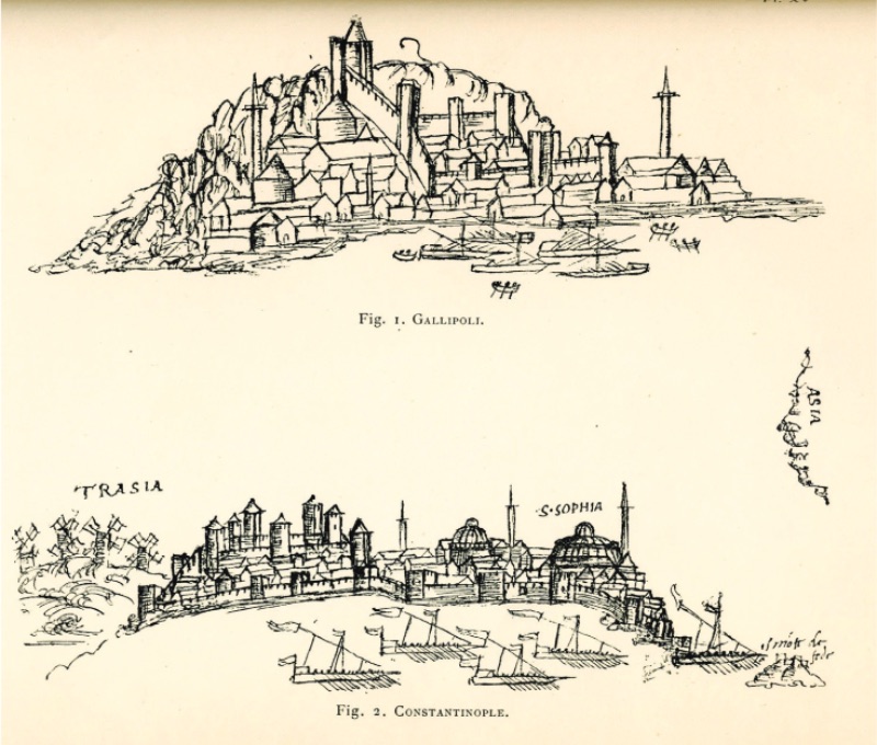
Gelibolu (Gallipoli) is a large city; the settlement that Strabo called Callipolis is established at the mouth of the Marmara Sea (Propontis) on the Thracian Peninsula; Lapseki (Lampsacus) is not directly opposite (as some say), but a few miles further north. Almost inland, it has two harbors for ships and boats, one to the north and one to the south, I thought the ships went to the southern bay next to the current. There are some old anchoring places on the shore. The city, like many cities in Turkey, looks more beautiful from a distance. The domes of mosques (or churches) and bazaars (or crowded places) are covered with lead, minarets (high towers with stairs where calls to prayer are made or bells are rung), long cypresses mixed with houses create a beautiful view. However, the houses are not very durable and low, usually made of wood and earth, the streets are narrow, sometimes covered with wood to protect from the sun. There is no wall around the city, as in many cities in Turkey, only in some places: They say only a six-mile section is surrounded by a wall. When we arrived in the city, they reported an outbreak of plague; it was said to be more widespread than in Istanbul (Constantinople). This situation is not very new in Turkey, it is very rare for there not to be an outbreak. We thought this was a good start for us and our companions to get used to it. However, we relied on the great power to protect humanity with great sadness.
It is not very crowded here, considering its size, I thought the plague outbreak might be the reason for this, or not, I am not very sure. At least it was said that there were twelve thousand Turks and four or five thousand Greeks and many Jews in the city. The bazaar is the only place to see here, covered with six lead-covered domes. We sat in an open place in the southern harbor, not daring to enter anywhere in such a place where we knew no one and moreover, there was a plague outbreak. But the Italian consul (a member of the Saint Francis society) was in the city, we hoped to sit in a more comfortable environment in his small monastery. This place is famous for having the best watermelon, we took as much as we wanted without paying anything, there were piles where we stayed. There are small remains from ancient times here, not much mentioned by ancient writers. There is a marble frieze in the southern harbor, quite damaged, and we also found a small inscription in the city, with the names of one of the Theodotus and Bitina, daughter of Anticles."