Ruins in Troy and Its Surroundings (1794, James Dallaway) Born in London in 1763 as the son of a banker, James Dallaway (1763-1864) became a member of the Society of Antiquarians of London in 1789, where he met with Philhellenists. Between 1794-1796, Dallaway came to Istanbul and served as a chaplain and doctor in the British embassy staff. He published his memoirs from this period in a book in London in 1797, which was later translated into two German and one French editions. During Dallaway's tenure, naturalist J. Sibthorp and painter G. Mercati also worked as embassy officials. Dallaway's impressions of the Çanakkale region and Troy are based on his journey with J. Morrit in 1794. Dallaway attempts to evaluate all the writings on Troy by travelers before and during his time, and he examines Ballıdağ in Pınarbaşı village, which was considered Troy at the time, in great detail. After returning to England, Dallaway served as the secretary to the Duke of Norfolk until his death and wrote books on English history:
"Within an hour, we arrived at Alexandria Troas; initially named Antigonia, the Turks call it Old Istanbul. The entire area here is now filled with valonia oak and acorns, which are rare in the Levant region. From a high point, Bozcaada (Tenedos) and the large tumulus Üvecik Tepe (Udjek Tepee) in the Trojan plain can be seen along with the sea; to the right, the surface below is particularly beautiful.
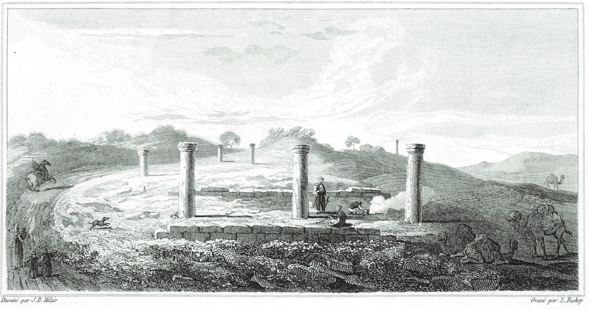
In our research, there is a very large substructure and above it, a platform attributed to a temple of Diana, according to old comparisons, called the Palace of the Maidens. Only the remnants of the old stadium, which is circular, remain, covered with greenery. The very large theater is quite impressive, with part of the portico and substructure, and perhaps some of the seats visible. The city wall near the sea extends inward; indeed, the remnants of walls several miles long can be seen, a few steps high in places...
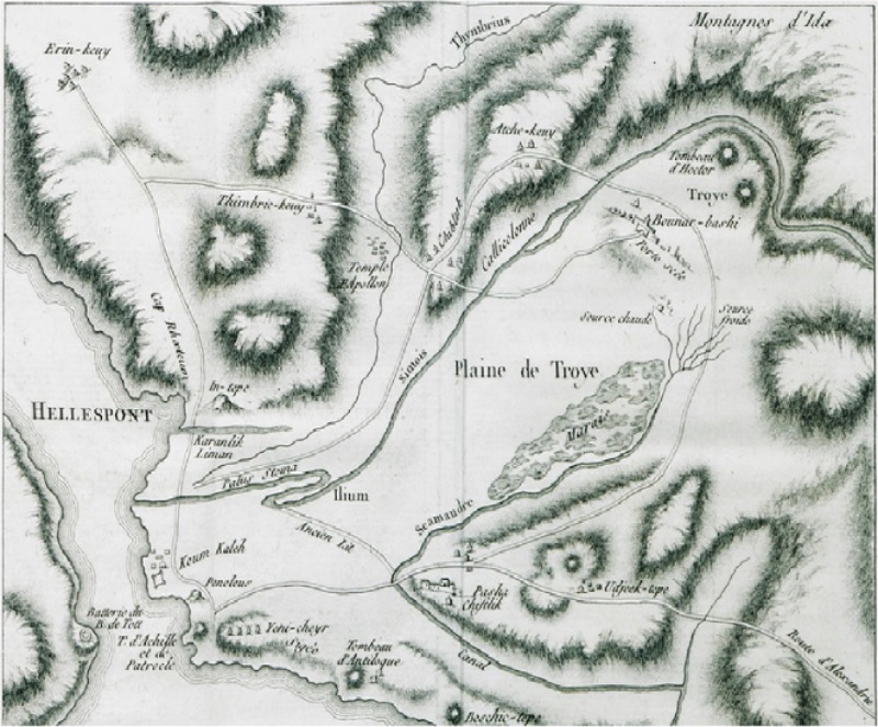
Sailors call this place (because it is noticeable from the sea) Priamos' palace ("Il Palazzo d'Ilione", Della Valle). However, the opinions of knowledgeable travelers differ. Pococke and Chandler attribute these ruins to a gymnasium; Chevalier, with better reasons, evaluates the ruins as public baths, similar to the structures of Titus and Caracalla in Rome... The Reflection of the Trojan War from Homer's Epics on Topography in the 18th Century (1784, Aguste de Choiseul-Gouffier)
Before reaching Lidga Baths, we saw very large remnants of the aqueduct of Atticus Herodes stretching towards the valley for several miles. The benefactor of the city must have been very generous for the necessary works, which are much more than a single structure; it is likely that the channel was opened from Karamenderes (Scamander) several miles away, and the trace of the water flow being connected to it can still be seen. The aforementioned stream is not suitable for general use as it is too mineral-rich.
The remnants and grandeur of Alexandria Troas that have survived to this day reveal the fame reached by a great Roman colony, even its wealth that lasted for two centuries. Belon, Sandys, and Pococke describe structures of which not even a small piece remains. The reason for such great destruction is very clear; the ruins were destroyed for the third time in the most devastating attack by the Goths. Upon the Sultan's order to collect marble and magnificent columns from around Istanbul to adorn the magnificent Selim and Süleyman mosques, remnants were transported from here. It is likely that this was not done for the first time; the above travelers mention very large columns waiting to be transported on the shore...
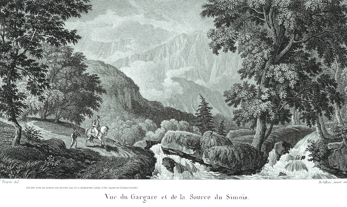
The inland course of the Dümrek Stream, anciently known as Simeois (1784, Aguste de Choiseul-Gouffier) The complete dispersal of these magnificent city remnants (if such a description can be made) was done by Captain Hasan Pasha during the last administration of the Sultan. During the Russian War, all the marbles that could be found near the Dardanelles were cut into cannonballs, and large weapons were made from the irons.
Similar marble cannonballs were also used by Mehmed II (Fatih Sultan Mehmet) during the conquest of Istanbul; thus, Hasan Pasha was not the first discoverer of such a barbaric invention...
On a stormy night, we stayed at a farm built by the famous Hasan Pasha, with columns and a large sarcophagus brought from Alexandria Troas.
Our first encounter with winter was on November 9th, so cold and stormy that it could have been such cold in England at the same time. After a little progress, we passed Dümrek Village (Thimbric-keuy) and a ruined mosque. The cemetery filled with columns and architectural pieces may have been erected in memory of the sacred city of Apollo Thymbreus and its temple.
We crossed the Karamenderes River (Skamender) and Dümbrek Stream (Simoeis); the last one we crossed had turned into a large river with rainwater, the riverbed being forty yards wide, but generally calm and drying up in mid-summer. Three hours ahead, we reached the seaside and the place with many round bays we saw from the European side of the Dardanelles (Hellespont). One of these is the site of the city of Dardanos, located under the Dardanian elevation, now known as Kara Burun or Berber Burnu, although there is no trace of a war here. When we arrived at the Asian castles known as Çanak Kalesi by the Turks and Dardanelles by Europeans, we witnessed the rare hospitality of the British consul Taragano, an Israeli Jew whose family had continued the same duty for nearly a century. His house truly has a patriarchal structure, with four married couples living under the same roof, five generations with faces very similar to each other (especially the women). After entering the city, we crossed a long wooden bridge built over Sarıçay (Rhodius), whose existence was denied by Plinius...
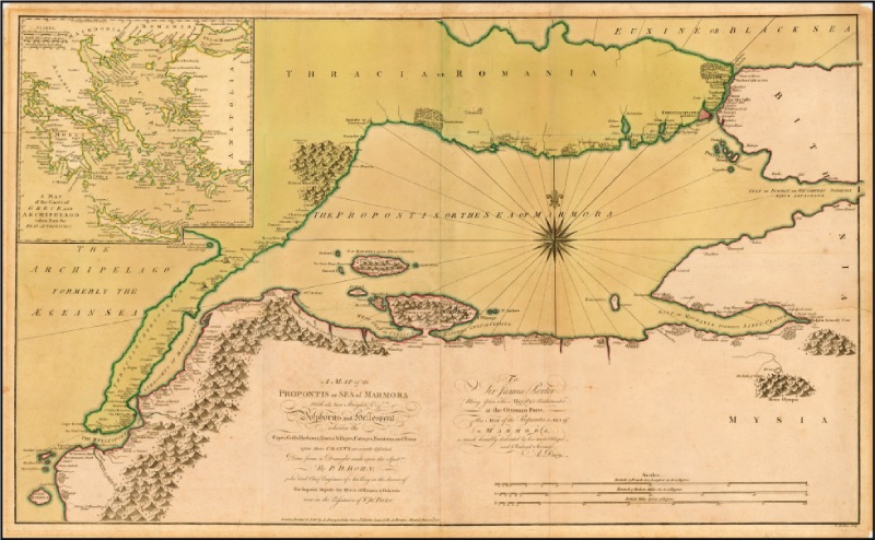
In Çanak Kale, there are two thousand houses of the worst examples of Turkish-style houses. We are touring the castle, which is from the late Greek period; the support walls are partly modern, said to be built with the Sultan's money. The trenches make a curved turn on the outer sides. There is a small park with cannons used by no one other than the Germans; some have very large calibers, and alongside them are marble cannonballs with a diameter of two feet, stacked like towers. The weapons are painted green. Here, there is a factory producing roughly painted and glazed pottery, which gives the city its name Çanak. The opposite Kilitbahir (Chelit bawri) castle, which is much smaller and further ahead, is Eceabat (Maydos/Maita); beyond that is the ancient city of Sestos. Section of the Region with Akçaköy and Pınarbaşı Villages (1784, Aguste de Choiseul-Gouffier)
The story of Hero and Leander, told by everyone, owes its beauty to the poems of Ovid and Musaeus.
The distance to the opposite shore, which is not more than a mile, although not easy, has been achieved by modern swimmers; indeed, it did not hinder Leander's attempt, but strong currents must have always posed a great obstacle.
Sestos was conquered by the Athenians in 479 BC, before Christianity. This proves the importance of the city in ancient times and thereafter.
We continued our journey by boat along the Dardanelles (Hellespont), over the cape about three miles away, to the place slightly above Nağara village, where the city of Abydos once stood, but today it is completely leveled and filled with vineyards. No architectural remains are visible, but we observed that the scattered pottery on the plowed surface continued to increase in this area. Nearby is the narrowest point of the strait. Abydos, founded by the Milesians, remained under their control for many years...
On our way back, a mound of earth caught our attention on the European side, above the castle named Kilitbahir (Chelit ul Bawr). This mound, quite conical in shape, is described by geographers as Cynossema or the tomb of Hecuba, located directly opposite the mouth of the Sarıçay (Rhodius) stream. This coastal area is much more beautiful than the others, with valleys covered with trees and plants, flattening out behind the hill. The coast mostly consists of slopes made of hard sand descending vertically like a wall. The springs of Mount Ida, various vineyards along the Asian coast; a forest in the center and also the view of numerous mountain peaks are magnificent.
"Important Settlements on the Dardanelles and the Coast of the Sea of Marmara (1770, PD Bohn)" With a very pleasant sailing trip, after an hour and a half, we arrived at the lower castles, more inland than the others, where Baron de Tott had placed cannons on the nearby rocks, visible to everyone but themselves. We landed at the village of Kumkale (Koum Kaleh) adjacent to it. The shape of the castle is surrounded by walls that are somewhat square; the direction of the domed road indicates that there could be powerful cannons on both sides facing the sea.
The castle was built in 1659 by Sultan Süleyman...
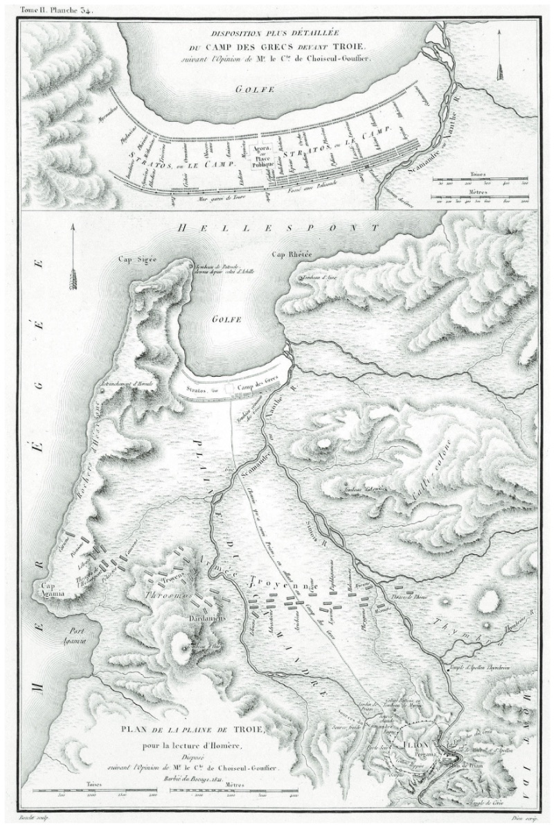
From this point, separate from the local history here, there is a most interesting perspective, beautifully described by Luan, with its charm etched in minds. On the left, there is a low plateau with hills, in the middle of which is the large area where the Greeks camped; beyond this, the places where the great events of the war took place are visible. The elevations of Bozcaada (Tenedos), Beşiktepe, Siegeum, and the distant view including Kumkale village and the extending line advance to the sea's edge and reach the Dardanelles (Hellespont). From here, the opposite cape and the castles on the shore create a quite impressive view. Here the sea widens considerably, and the view integrates with the blue mountains of Gökçeada (Imbros). The descriptions giving the length and width of this island are quite confused; there seems to be no map giving even more than half of its actual size. On horseback, we traveled for half an hour through high terrain covered with shrubs to Halileli (Halyleli) village near Dümrek village (Thimbrik). As we passed, the villagers were holding a village wedding, common in the summer months. The families of both sides or the groom's side alone give gifts to the other side to take the bride. Meanwhile, the groom gathers with his friends. All on horseback, they come to the village with quite loud music played with drums and zurna. The bride is requested, and at the same time, the bride's female relatives accompany her, and then they return home with the same music. The two sides sit in different places to eat pilaf and continue until the entertainment ends in the morning.
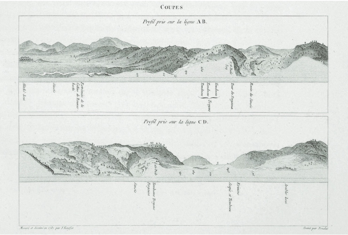
In the distance, five tomb mounds on the horizon stand as the most important evidence of the Trojan War. An hour and a half west of Pınarbaşı (Bournabashi), we discovered the remains of an ancient city, easily noticeable. To our right stood seven granite columns a few feet high, but they seemed not to be in their original places. On the other side, we saw a small marble block with an inscription; this inscription, a few inches dug out from the surface, belonged to the Roman imperial period and was too damaged to be read... Ruins Near Asarlık_Hisarlık Believed to be Ancient Troy (Çıplak Village) (1784, Aguste de Choiseul-Gouffier)
...
As the sun set much more beautifully than on many previous days, Pınarbaşı (Bounar-bashi) village presented a beautiful view along the Dümrek (Simoeis) stream. Within the borders of the land of the old kingdom of Priam, we passed near the farm of Hacı Mehmet Ağa, producing approximately 500 pounds sterling worth of production annually on slightly less land. Here, meaning home, many columns collected from the nearby ancient cities stand scattered around.
As we left the village, the hills suddenly steepened and soon turned into isolated mountains. Behind the house, at a short distance, is the first source of Skamender (the author mistakenly interprets the water sources here as the source of the Karamenderes River. R.A), which M. Chevalier presents as the most important evidence of his hypothesis that this is the city of Troy. At least warm, and the agha told us that the water is hot and steaming, especially on frosty days in winter. Once a year, Homer has the privilege of a hot spring and a full-flowing river.
...
Later, we stopped at Gavur village (Giawr-keuy) or Yenişehir (Janissary), a poor village inhabited only by Greeks; this is the same name as Yenişehir (Yeni-chery), the site of the famous city of Sigeum...
Examples of Artifacts Found Around Ancient Troy (1784, Aguste de Choiseul-Gouffier) Here we found the famous Sigean inscription, written in the half-relief style and in the alphabet invented by Cadmus, which could continue forward and backward, also used by Suidias when writing Solon's laws, fashionable in the late antique period. The villagers, due to their old beliefs, prevented M. Choiseul's attempt to take the inscription with the help of a decree and Hasan Pasha. The inscription, detailed by Chishul, Shuckford, and Chandler, stands like a chapel at the door of a low hut. The inscription is almost erased as it is constantly sat upon like a bench. Above the plateau, a little beyond, we saw the hill (beshic tepe=Beşiktepe) called the tomb of Antilochus by Strabon. On the other side of the village, under a tomb mound on the elevations, there are half a dozen windmills; by the sea, there are two small tumuli said to be the tombs of Achilles and Patroclus, very close friends according to ancient geographers. After the discoveries made in 1787, by order of the former French ambassador M. Le Compte de Choiseul Gouffier, some dervishes built their lodges opposite it and constructed a hut of earth on top...
According to detailed information given by a friend who was the only person present at the opening of the tomb mound, the list of artifacts claimed to have been found does not confirm the letter sent from Çanakkale (Dardanelles):
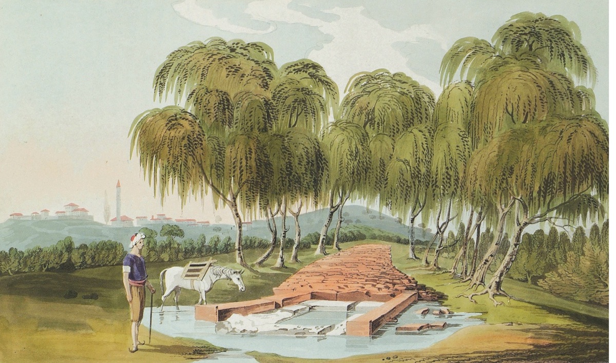
"I had a very interesting meeting with the son of the last French consul, Senyör Salomon Ghormenzano, regarding the excavation of the Achilles tomb mound near the Sigean plateau. He stated that he was assigned by Count Choiseul Gouffier to investigate the remains in the tumulus; they deceived the agha and villagers by saying they would work at night to find the water source needed by Yenişehir (Yencheyr). After two months of this work, no one else was interested in the matter. When they found nothing, suspicions frequently increased, but the order was given to find the artifacts. Eventually, he discovered where the artifacts were hidden. He immediately collected all the artifacts and filled a chest with what he found, contacting the person who assigned him this task. Mr. Choiseul ordered him to bring the findings to him, instructing him not to show them to anyone else; however, he only received a thank you for all his efforts. He was very excited to obtain some small findings, and after showing and explaining the findings to us, his excitement subsided..."Kırkgözler Water Springs Near Pınarbaşı Village, Believed to be the Site of Ancient Troy (1801, William Gell)
Due to their very old age and the heavy pressure of the soil, the metal findings were broken into small pieces. The urn or vase, repaired from its damaged form by the master artist M. Fauval, who now lives in Athens and received it from M. Choiseul, was interpreted as proof that Troas would continue to be the land of discoveries, with many pieces of information shown as a magical surprise, "with chariots and four horses" that goddesses, and the discovery of Troas as the land of exploration..."
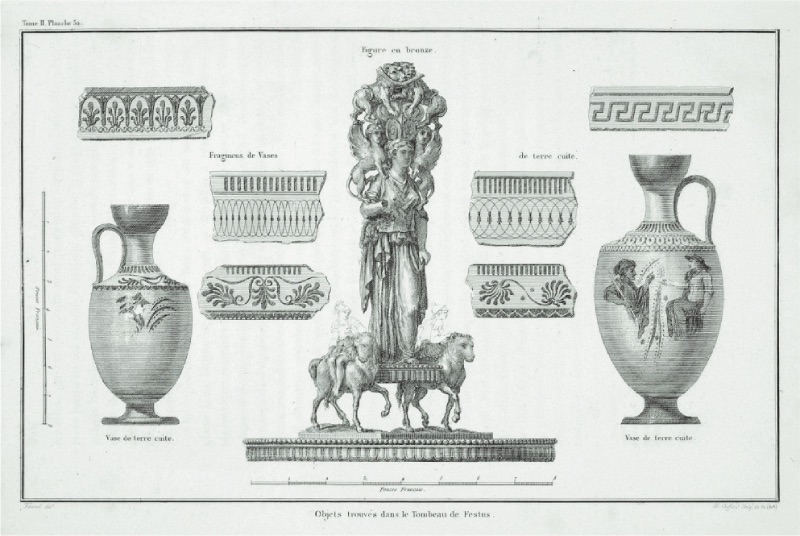
Artifacts Unearthed from 18th Century Excavations at Festus' Tomb Near Troy (1784, Aguste de Choiseul-Gouffier)