Western Anatolia and the Çanakkale Region (1818, Robert Walpole) American zoologist James De Kay (1792-1851) was born in Lisbon, Portugal, but spent most of his life in America after his family moved to New York when he was two years old. He completed his education at Yale between 1807-1812, but later studied medicine at the University of Edinburgh and earned his medical doctorate in 1819. After returning to America following his education, he married Janet Eckford, the daughter of shipbuilder Henry Eckford. When his father-in-law took on a shipbuilding project for the Ottoman Empire, he visited Turkey with him in the capacity of a ship technician. In his work describing his travel notes from 1831-1832, although the typical travel writing style of the period prevails, his writings were criticized by European intellectuals as being anti-Hellenistic and naive. In the second half of his life, De Kay returned to New York, completely abandoning his medical education and turning to natural history. In De Kay's memoirs, his observations on the cholera epidemic and its treatment in Istanbul, particularly as a medical doctor, are noteworthy. However, his detailed information about the Ottoman Navy, the relationship between Muslims and non-Muslims in the Ottoman Empire, and his observations on the Ottoman economy are also quite interesting. De Kay distinguishes himself from many other European travelers with his impartial attitude towards Turks and Muslims. For this reason, his writings were mercilessly criticized by Panhellenists. What he wrote about his visit to the region where the Plain of Troy is located clearly demonstrates how well he read and critically evaluated the research up to his time.
"At twilight, we anchored between Bozcaada (Tenedos) and the coast of Troy. The wind and the current from the Dardanelles were in the opposite direction. Here, it is worth recalling a poem written with skill by the Roman poet Virgil:
Tenedos, the island with a very famous name, finally appears
Very wealthy while Priam's kingdoms ruled.
The poet, who probably never spent his life in saltwater, if he meant it was dangerous due to the anchorage, contradicts our most reliable record, the logbook, which claims we anchored at a point thirteen fathoms deep, soft and muddy...
Lapseki and Surroundings (1811, Antoine-Laurent Castellan) Tired of being confined, restricted, and imprisoned on a ship for a long time, and eager to set foot on land as soon as possible, we left the ship as soon as the anchor was dropped and, due to its proximity, soon stepped into the city of Tenedos on the shore. As we entered this small harbor, shaded by strong and large white fortifications on the north side, it was already dark. The harbor was filled with small boats of almost every kind imaginable, and it was difficult for us to reach the landing place. Here, we encountered a Turkish security officer who politely asked what we were doing and, after learning that we were impatient to obtain human comforts such as meat, wine, etc., offered to take us to the house of the English consul. We climbed a short hill that brought us to the center of the city.
The houses were low buildings made of mud and wood, covered with flat roofs...
We met the English consul at the door and were formally introduced. It had been our fortune to meet strange examples of humanity, embodied in the form of American consuls, distributed in various parts of the world and especially in the Mediterranean by our naval commanders. However, generally more carefully selected and better-paid English consuls are entirely different personalities. Therefore, our astonishment can be imagined when we met a man who resembled a long gray-bearded, ragged, dirty, old and elderly junk dealer as the English consul. He was dressed in Greek attire, his feet disdained such vulgar loads as shoes or stockings, and with the full air of a consul, he carried a dozen poultry in one hand and a basket of eggs in the other. His name was II Signor C., he was of Venetian descent, and he was born and raised on the island. He spoke a very bad, unintelligible language that replaced Greek, Turkish, and Italian. There is no need to add his profound ignorance of English.
I asked what the island's inhabitants were generally occupied with. "Making wine," he replied.
"But that only lasts two months, what do you do for the remaining ten months of the year?"
"Aspettanto signor" (They wait, sir).
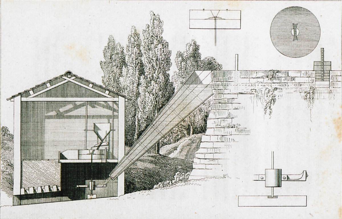
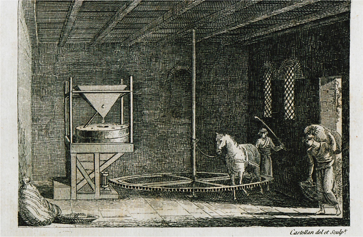
Bozcaada is indeed known for the laziness of its inhabitants as much as for its excellent wine. It is said to house a population of 3,000, including a garrison of 200 soldiers. The island, originally settled by those from Greece and known in poetic history as the place where the Greeks hid behind to catch the Trojans unprepared, was occupied by Persians, Greeks, and Venetians until it fell into the hands of the Turks. As it could be a great base to harm navigation in the Dardanelles in enemy hands, the Turkish government spared no expense to complete the fortifications as much as possible. Cross-section of a Mill in Lapseki (1811, Antoine-Laurent Castellan)
The next morning, we were on the move at daylight and spent the entire day battling the wind of Troy and the strong current sweeping from the Dardanelles along the coast of Troy. Much has been written about Troy, but the uncertainty about whether its exact location exists continues. The Trojan War lasted ten years, and the war about Troy has been going on for as many centuries. Since the unfounded rhapsodies of poets are considered as accurate as the pages of a modern travel guide, it does not seem to be ending soon. The poems attributed to Homer are thought to have been written 400 years after the destruction of Troy, and it is known that they could not have been written until 300 years later due to the lack of suitable writing materials until then. However, serious and scientific theses about Troy still rely on such unfounded documents. Alexander, who always carried a copy of the Iliad with him and admired or seemed to admire Homer's heroes, visited this plain two thousand one hundred years ago and offered wreaths and sacrifices at the place shown to him as the tomb of Achilles. It is said that he ascended from there to the storm-battered city of Priam, but Strabo has shown that Alexander was deceived by believing that the Ilium of his time was the old city of Priam...
While examining the reports of travelers who visited this famous spot, it is very interesting to see how imagination completely took over common sense and how they made authoritative statements on a subject that Strabo, who wrote 1800 years ago, could not explain...
But we leave behind the wine-flavored Homer and his wonderful stories; our business is the plains of Troy as they appeared in the summer of 1831.
The place called Troad or the Plain of Troy is approximately thirty miles long along the coast and extends from the Dardanelles to the Gulf of Edremit. Both ends are terminated by rising land masses, with Siegeum or Yeniçeri Cape in the north and Baba Cape in the south. As you travel along the coast, you see a barren plain surrounded by a low range of hills in the distance. The highest of this range is called Ida. Some of the pyramidal mounds of earth have been fancifully named Hector, Esyegetus, Priam, Ajax, Protesilaus, etc. Regardless of historical or mythical associations, the plains of Troy present a bleak landscape. They are covered with thistles and various ground oaks and are often subject to flooding in winter...
The next day, we received the assistant of the Pasha of the Dardanelles and his accompanying interpreter, the Italian physician Dr. Lazaro. The assistant, who held the rank of colonel, was dressed in a splendid military uniform and, if not for the red fez or Turkish headgear, could have been mistaken for a European officer... Interior of a Mill in Lapseki (1811, Antoine-Laurent Castellan)
In the afternoon, a gift arrived on behalf of the pasha consisting of fresh beef, half a dozen sheep with broad tails, extraordinarily good lobsters, a bunch of delicious white and black grapes, eggplants, okra, and other vegetables. This was accompanied by two demijohns of the region's finest wine. According to Eastern customs, a gift always requires a return; therefore, we implored his excellency to accept a few cases of the best American cider we had, as we could not find anything better.
The Dardanelles, or Hellespont as it is known, according to the map, is approximately 50 miles long until it begins to widen towards the Sea of Marmara at Gallipoli. Its width varies between two and five miles; but at its narrowest point, as at the above castles and Abydos, it does not exceed one and a half miles. The constant current flowing towards the Mediterranean at a speed varying between one and four miles per hour poses a great obstacle to trade. Since the wind generally blows from the direction of the current, ships are delayed for days and even weeks waiting for a favorable wind. We learned that an American ship waited here for a suitable breeze for a full month last year, and the unfortunate Austrian ship was delayed for fifty-eight days.
While making predictions about the possibilities ahead and waiting for a tedious delay, our guide, carefully watching the southern horizon at the entrance of the straits, announced that the wind was coming from the sea and joyfully gave the order to weigh anchor. We immediately set off with all kinds of sails belonging to all nations and literally turned the Hellespont white with our sails. Among these ships were Italian vessels, Dutch galleys, Greek trabaccolos, Greek mystikos, English mystikos, English brigs, and a fleet of Turkish galleys and sakkalavya.
As we approached the huge castles dominating the narrowest part of the Dardanelles, a scene of a different nature emerged.
As a gesture, we hoisted a large Turkish flag, and suddenly a hundred flags appeared from each of the forts on both sides of the strait. The consuls of European nations living here also hoisted the flags of their countries, and the long line of white crenellated parapets was filled with spectators.
In the afternoon, we set out to visit a small village called Maito, pleasantly situated on the edge of the deep bay below us, previously used as a naval base by the Athenians. Crossing the point where Xerxes bridged, directly opposite Abydos, we reached the village at dusk and proceeded to its principal coffee house... The village was on a low and marshy piece of land, and almost every road we passed had a filthy puddle in the middle. It was formerly praised by Xenophon under the name Madytus (Eceabat), but its current feature was limited to supplying Greek carpenters and masons to Istanbul...
The next morning, we crossed to Abydos; after barely walking through fields covered with wild thyme, the reward for our investigation was a few ruined walls and cellars of dubious antiquity...
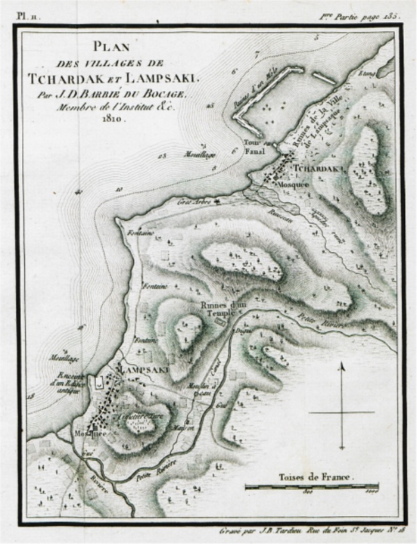
Passing through the towns of Fındıklı, Karavaova, and Galata, we soon came alongside Lapseki. This place gained fame in antiquity under the name Lampsacus...
As the wind picked up, we came abreast of Gallipoli, the largest city on the European side of the Hellespont. The city, pleasantly situated on the slope of a hill overlooking the bay, with an impressive and rocky cape extending from its edge and an awe-inspiring octagonal tower that once served as a lighthouse rising above it. In contrast to the conflicting accounts of travelers estimating the population between 15,000 and 80,000, the twelve minarets that can be counted from the ship provide a more acceptable idea of the city's size..."