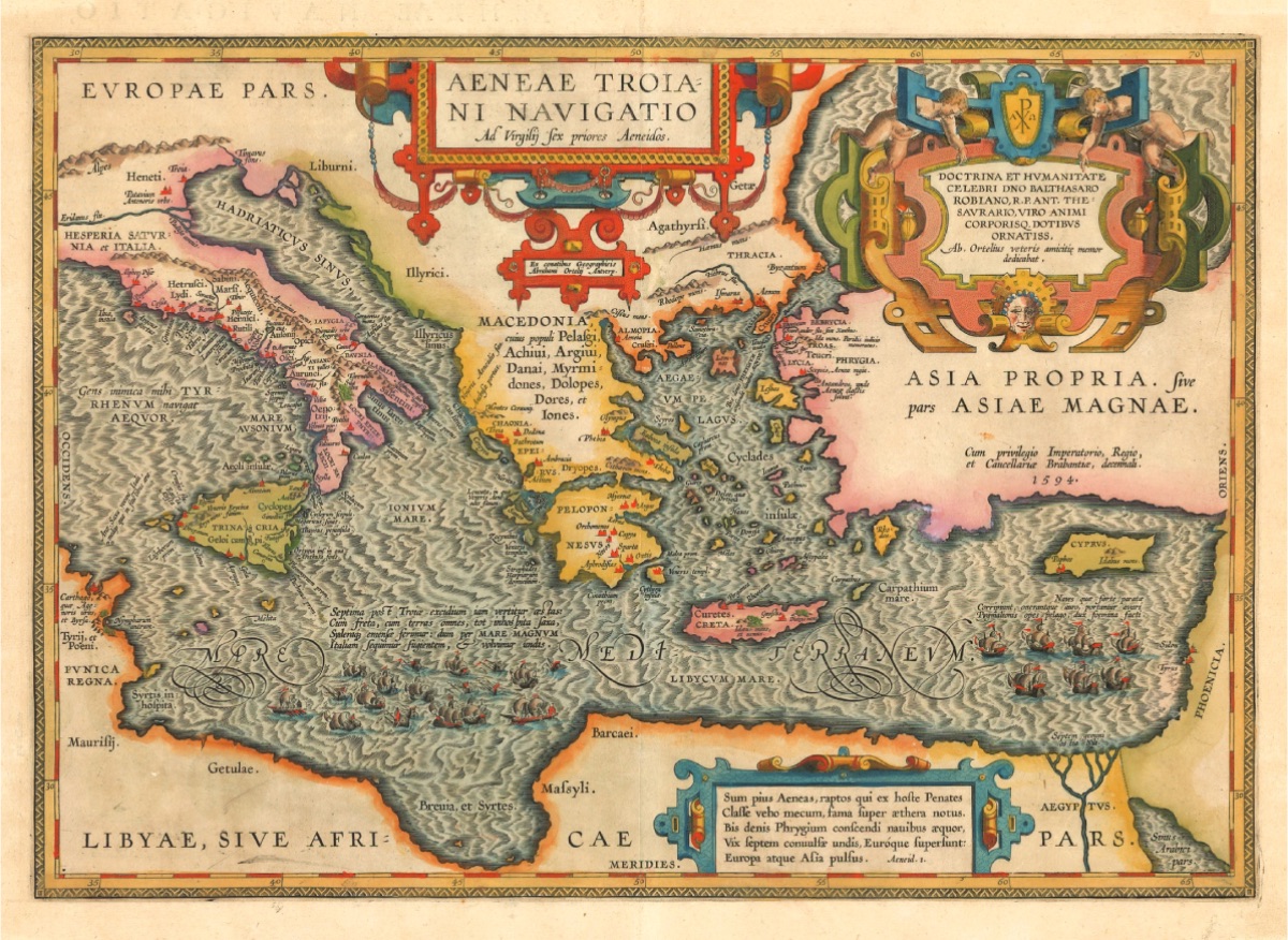
Map of the Eastern Mediterranean Showing the Route of Aeneas (1594, Ortelius, Aeneae Troiani Navigatio) Jean Thevenot (1633-1667) was born into a wealthy family in Paris. He developed an interest in Eastern societies at a very early age and learned some Eastern languages. His education was greatly influenced by the famous orientalist of the time, Barthelemy d'Herbelot. Before embarking on his travels, he studied under him, and his journey to the East began in Rome on May 31, 1655. Thevenot arrived in Istanbul on December 2, 1655, and after staying there until August 30, 1656, he visited Bursa, Izmir, and the Aegean islands. After returning to his country, he traveled many times, but on his last journey, he went as far as India via Egypt, Palestine, Iran, and Iraq, and died in Iran in 1667. As he wrote in his travelogue, he traveled solely for the purpose of learning and had the opportunity to get to know the Turks in Istanbul closely because he spoke Turkish. The information he provided, apart from religious topics, is impartial:
"Three or four hours after midnight, we noticed land, but we did not know if it was Bozcaada; unfortunately, we continued our journey at dawn and realized that we had just passed it. We were very close to the shore in front of Troy; our captain woke up with the noise of the ship running aground and, thinking he was lost, ran to the bilge to see if there was much water, but found nothing there. Meanwhile, he had a boat lowered into the sea and went around the ship to assess the damage, only the anchor was dropped from the stern (pupa) of the ship, and with its help, we were able to get out of the sand in a short time; here, God truly helped us because there was such a strong wind that the ship was in danger of sinking. Nevertheless, we escaped within an hour, without even a drop of water entering the bilge; if the place where the ship ran aground had been rocky, the ship would have sunk. While the crew was making every effort to save the ship, forgetting the danger of sinking, I was still imagining the ruins of the old and famous city of Troy, which was remarkable and spread over a large area; finally, we escaped the difficult situation and moved away from the land and entered the Dardanelles around 9-10 o'clock; this is the place where the Turks crossed from Asia to Europe.
Both of the fortresses of Çanakkale are on the shores of the Dardanelles.
One of these fortresses, which are within cannon range of each other, is on the European side, and the other is on the Asian side, with a distance of about two miles between them; this is the entrance to the strait. The fortress on the European side was called Sestos during the Roman period; it was built at the foot of a triangular hill dominating the strait, and there was a town on this hill. This fortress has three lead-covered towers, two of which are on the land side, and the largest third one is over the harbor; with my telescope, I could secretly see about twenty embrasures, which contained large cannons, and I also noticed with my telescope that a man could easily enter here.
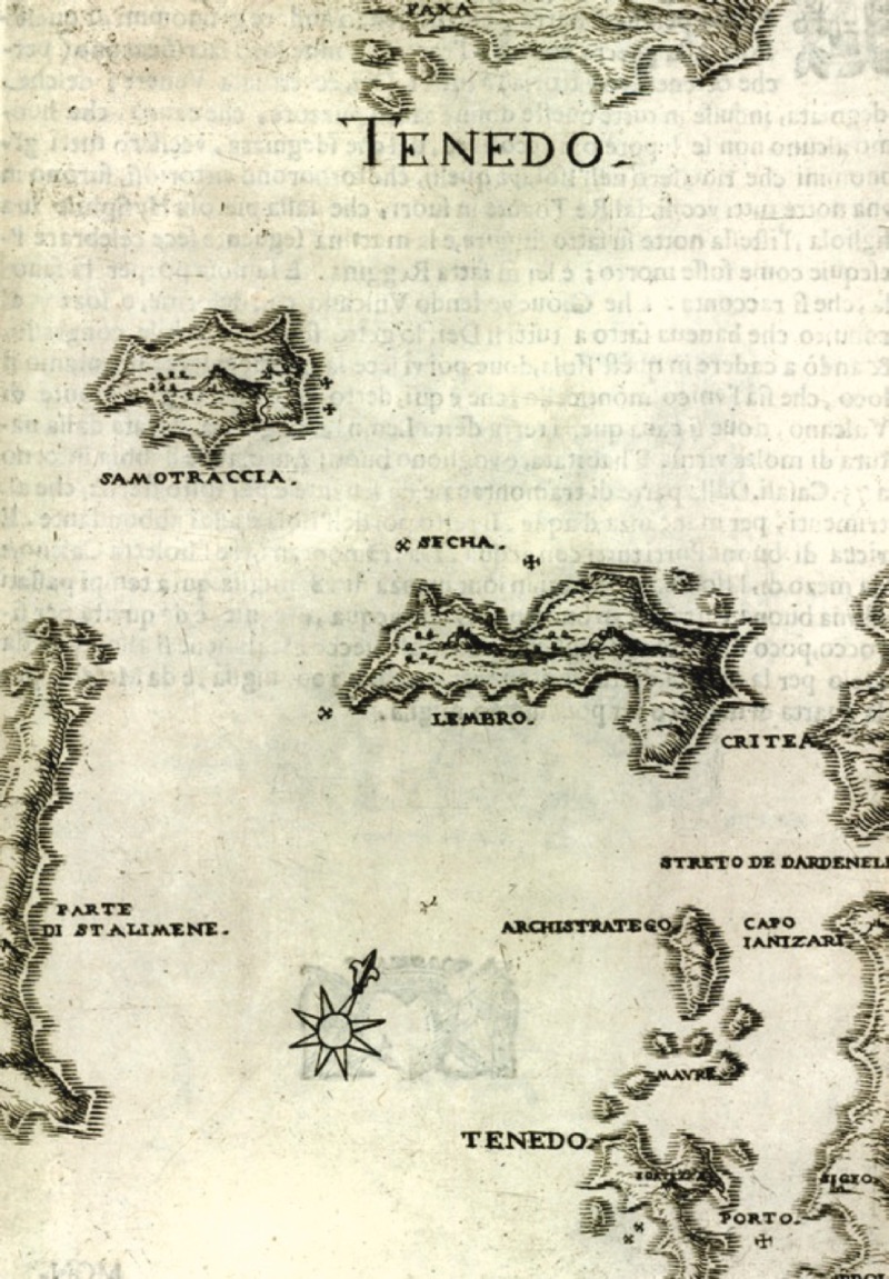
The other fortress on the Anatolian side in Asia, where Abydos used to be, was on a plain and was almost square-shaped; it had three towers on each side and a keep in the middle. It did not have as many embrasures as the other; these two fortresses on the Asian and European sides, which are truly the key to Istanbul, located 200 miles away, were built by Murad II's son, Mehmet II. The fortresses were places where no friendly or enemy ship could pass without stopping, or if they did, they would eventually face danger. All ships coming from Istanbul would stop in front of the fortress on the Anatolian side for three days to check if they were carrying contraband goods or slaves. Bozcaada and Gökçeada (1658, Marco Boschini)
Sestos and Abydos, these two places are famous for the love of Leandros and Hero. Near this place, Persian King Xerxes had a bridge built from ships to pass his army from Asia to Europe. There is a distance of approximately 280 miles between Andra and the fortresses.
Gelibolu was not very crowded, and people could only be found in the market; most of the residents were Greeks, and a large number of them sold raki or other alcoholic beverages. The doors of their houses were only 2.5 feet high (1 foot = 30.48 cm, R.A.). They found this solution because when the Turks were drunk, they would ride into the house on horseback and turn everything upside down. In this city, there was a square-shaped fortress with a tower; I assume it was built by Christians due to its old age.
On the shore, there was a shipyard where seven old galleys were seen. The Turks say they took these from the Venetians when they conquered the island of Cyprus, but in fact, the galleys are from the fleet that survived the Battle of Lepanto, and they transported them overland with human power through the Gulf of Corinth to pass them into the Aegean Sea because the Christians who had captured the other ships had occupied the passages."